Creative Mapping
As a school, we have been working hard to learn how to make maps in different ways. We have drawn maps, built map and made them!
.jpg)
PXL202305101403061801)
PXL202305101403061801).jpg1970PXL202305101403061801)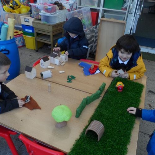
Reception have linked their Geography and Literacy learning. They used building blocks to make a map of the town where 'The Smartest Giant in Town' lives.
Reception-SmartestGiantmap.jpg561Reception have linked their Geography and Literacy learning. They used building blocks to make a map of the town where 'The Smartest Giant in Town' lives.
Reception used their maps to retell the story of 'The Smartest Giant in Town'
RetellingtheSmartestGiantstorywithmap.jpg562Reception used their maps to retell the story of 'The Smartest Giant in Town'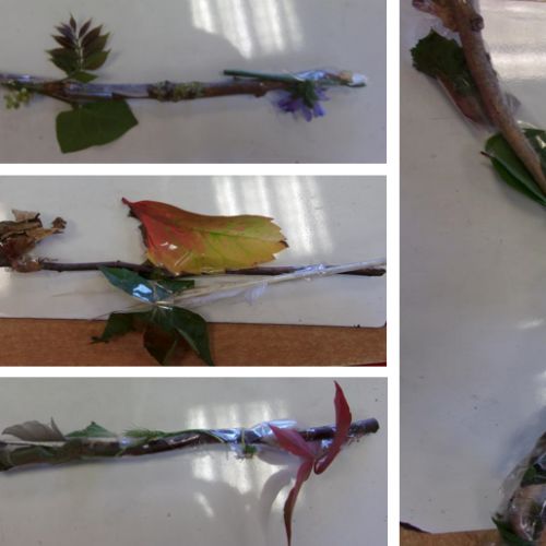
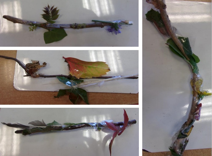
Year 2 made Journey Sticks by collecting items we found on a walk around the school grounds. The things we collected helped us to remember the route we took.
Journeysticks.PNG563Year 2 made Journey Sticks by collecting items we found on a walk around the school grounds. The things we collected helped us to remember the route we took.
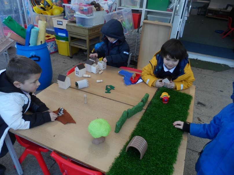
We used our journey sticks to create a Messy Map of the school and the immediate local area in a plan view
Messymapping.jpg582We used our journey sticks to create a Messy Map of the school and the immediate local area in a plan view.PNG)
In our China topic, we made Messy Maps of larger areas. We learnt about different types of settlement and we used our learning to make a messy map of the city of Beijing, the town of Shoreham and what a village might contain.
Models1).PNG584In our China topic, we made Messy Maps of larger areas. We learnt about different types of settlement and we used our learning to make a messy map of the city of Beijing, the town of Shoreham and what a village might contain.
Here is our Messy Map of Beijing
Beijing.png583Here is our Messy Map of Beijing.png)
Here is our Messy Map of the town of Shoreham
Shoreham1).png585Here is our Messy Map of the town of Shoreham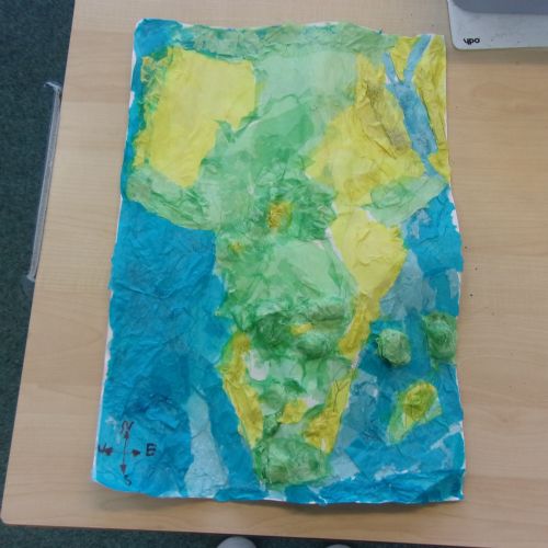
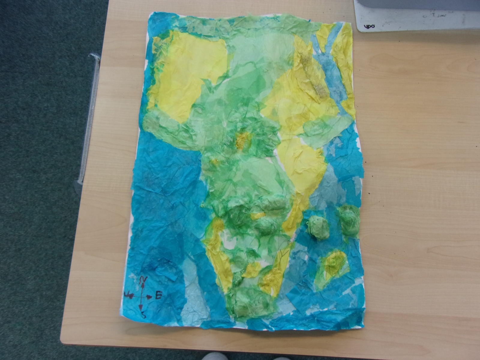
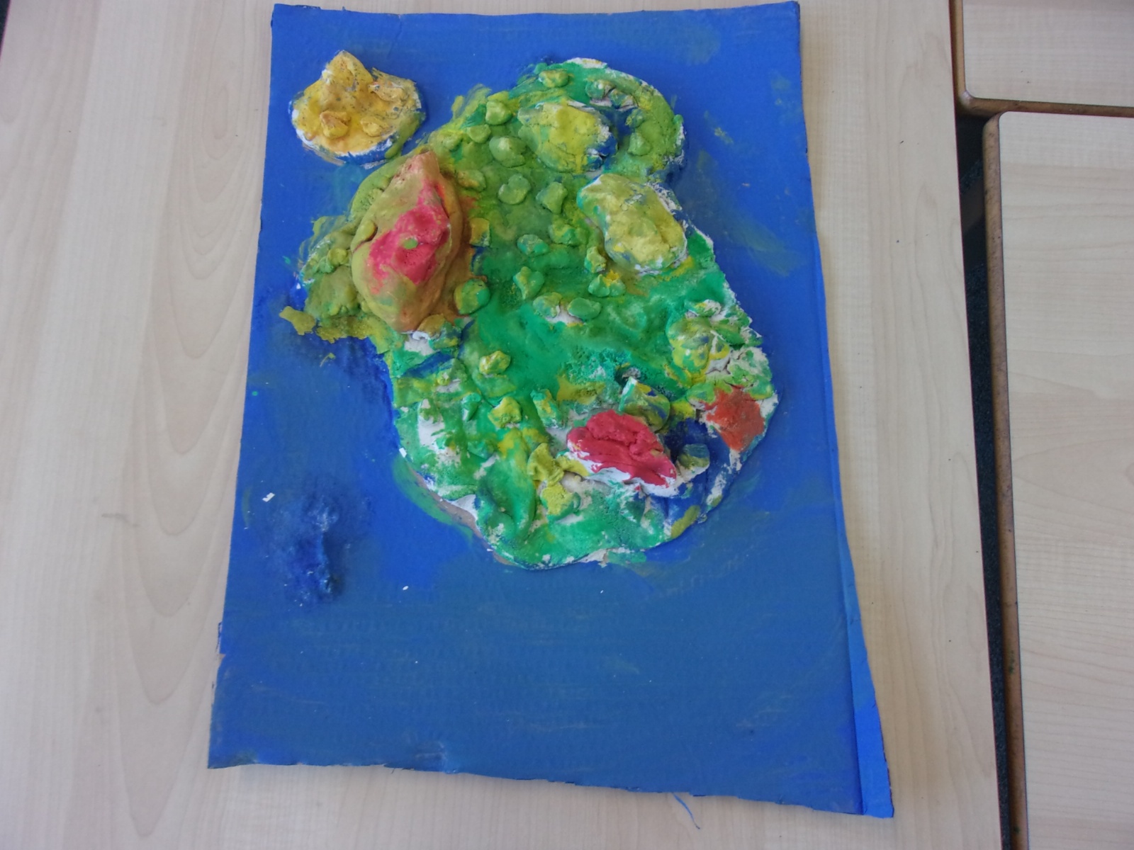
Year 3 made Saltdough maps of parts of Africa to help them learn about the relief of the land and to locate rivers
1023416.JPG559Year 3 made Saltdough maps of parts of Africa to help them learn about the relief of the land and to locate rivers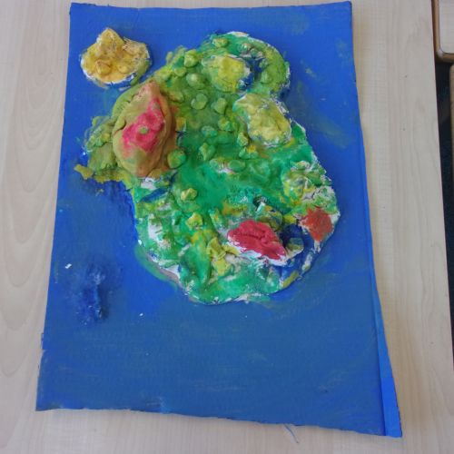
Year 3 made Saltdough maps of parts of Africa to help them learn about the relief of the land and to locate rivers
1023411.JPG558Year 3 made Saltdough maps of parts of Africa to help them learn about the relief of the land and to locate rivers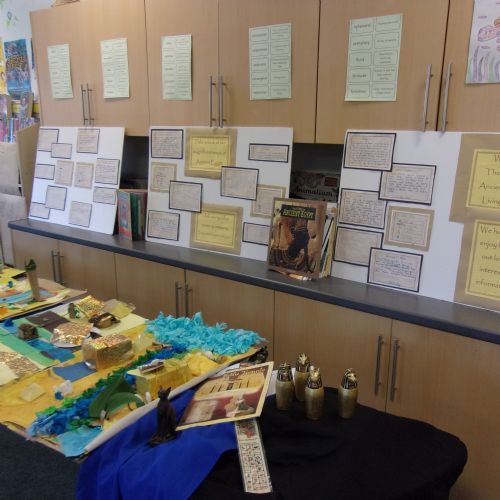
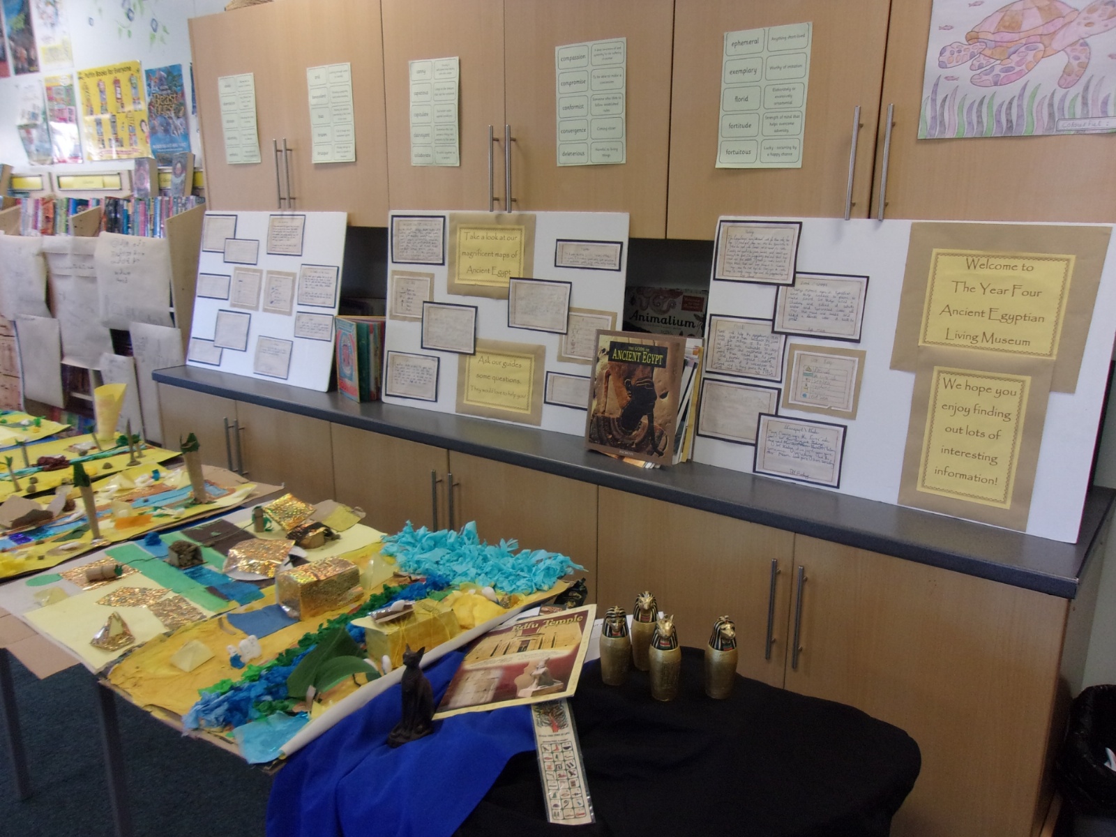
Year 4 made Saltdough maps of Egypt to help them . They displayed them as part of their Living Museum
1023500.JPG560Year 4 made Saltdough maps of Egypt to help them . They displayed them as part of their Living Museum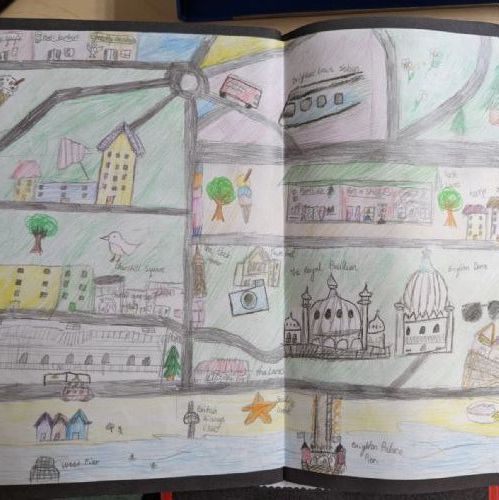
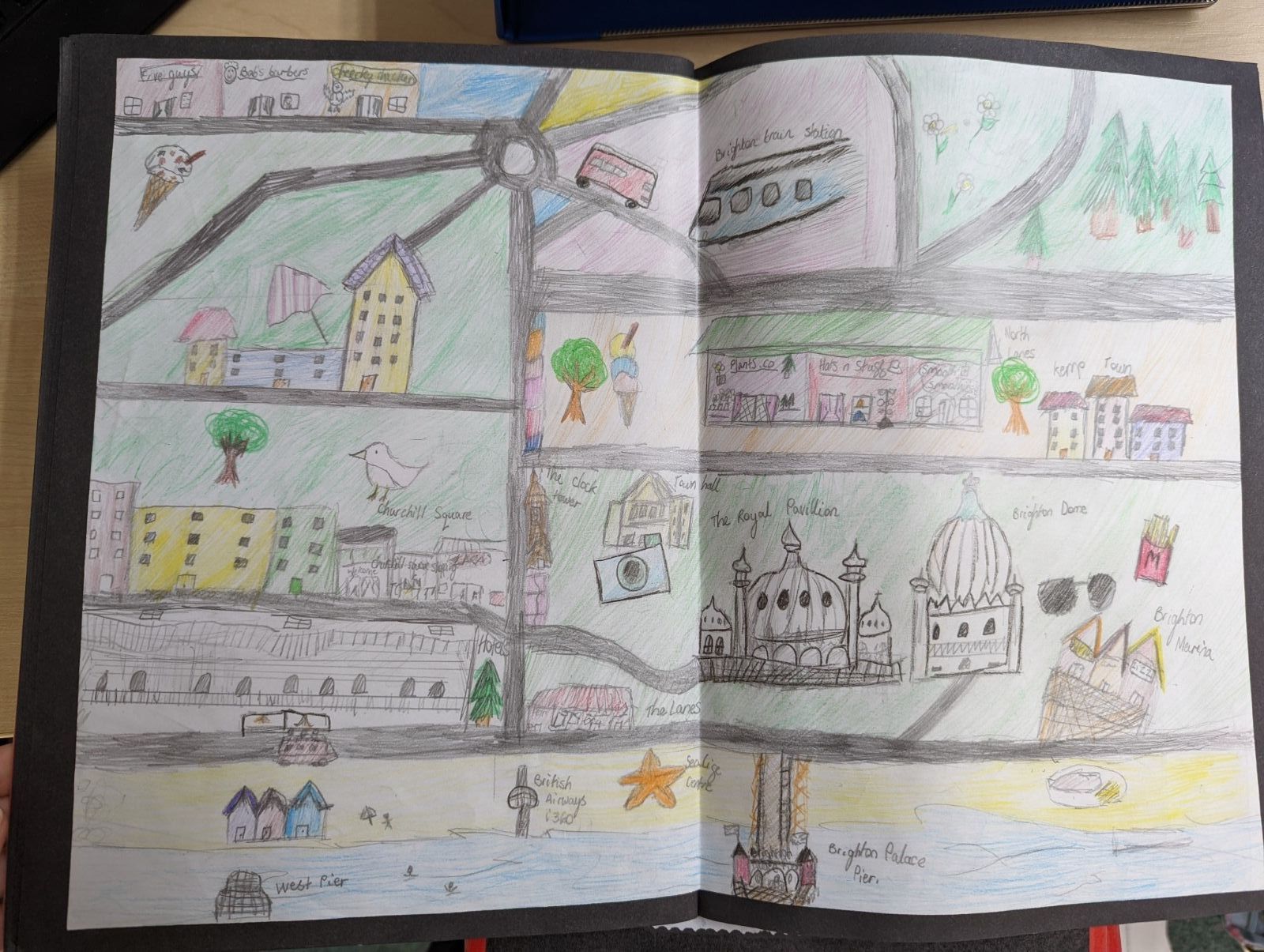
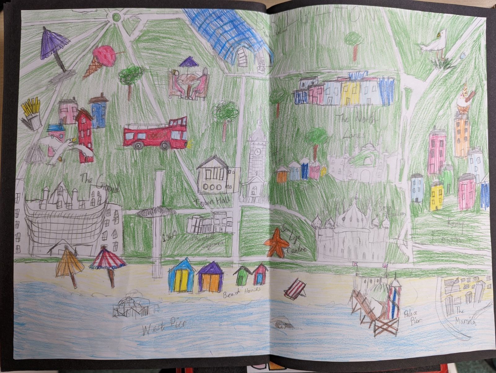
Year 6 made a Messy Map of Brighton before drawing their own maps
PXL20220118113112504.jpg587Year 6 made a Messy Map of Brighton before drawing their own maps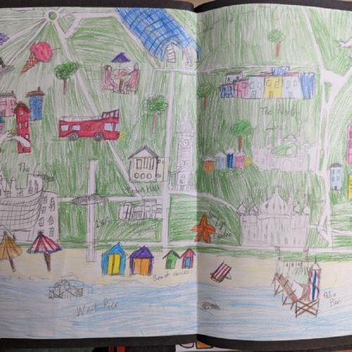
Year 6 made a Messy Map of Brighton before drawing their own maps
PXL20220118113004696.jpg586Year 6 made a Messy Map of Brighton before drawing their own maps
.jpg)

.PNG)

.png)