Year 2
Check out some of our Geography learning in Year 2!
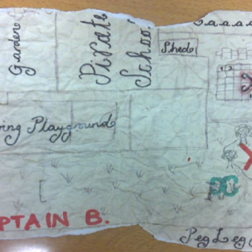
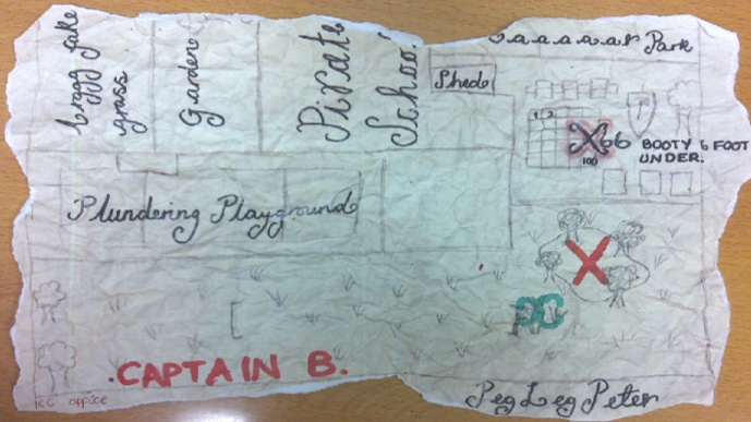
Captain Barnacle's treasure hunt
CaptainBarnacletreasuremap.PNG2801Captain Barnacle's treasure hunt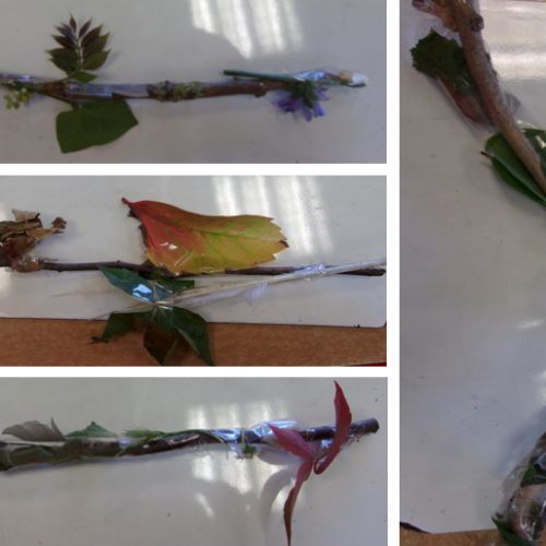
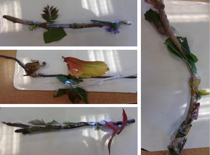
We made journey sticks to help us remember the route we took around the school grounds
Journeysticks.PNG2803We made journey sticks to help us remember the route we took around the school grounds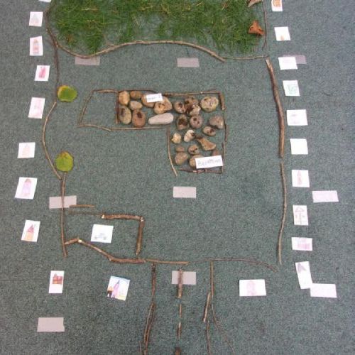
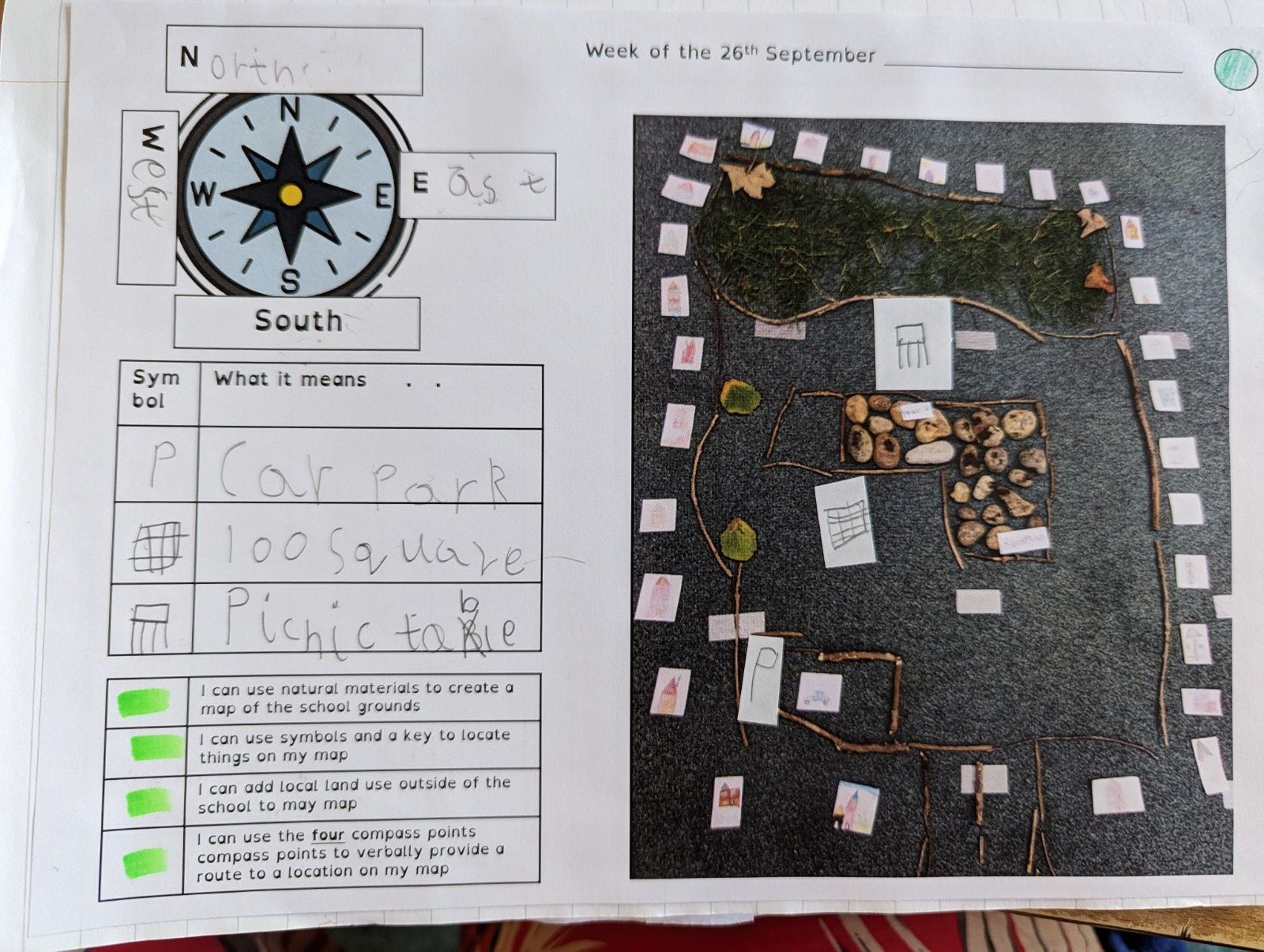
Our messy map of the school grounds.
1534146.JPG2811Our messy map of the school grounds.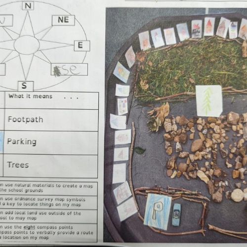
We used our journey sticks to help us make our messy map of the school grounds and what surrounds the school.
Messymapping.jpg2806We used our journey sticks to help us make our messy map of the school grounds and what surrounds the school.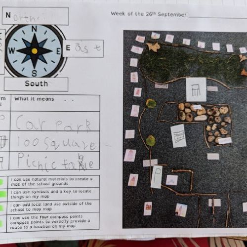
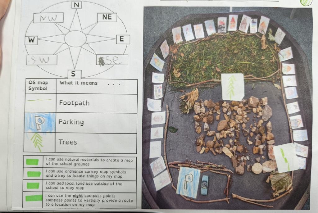
We put symbols and a key onto our maps. We used compass points to describe the location of different things in our school.
PXL20230623150148281.jpg2815We put symbols and a key onto our maps. We used compass points to describe the location of different things in our school.
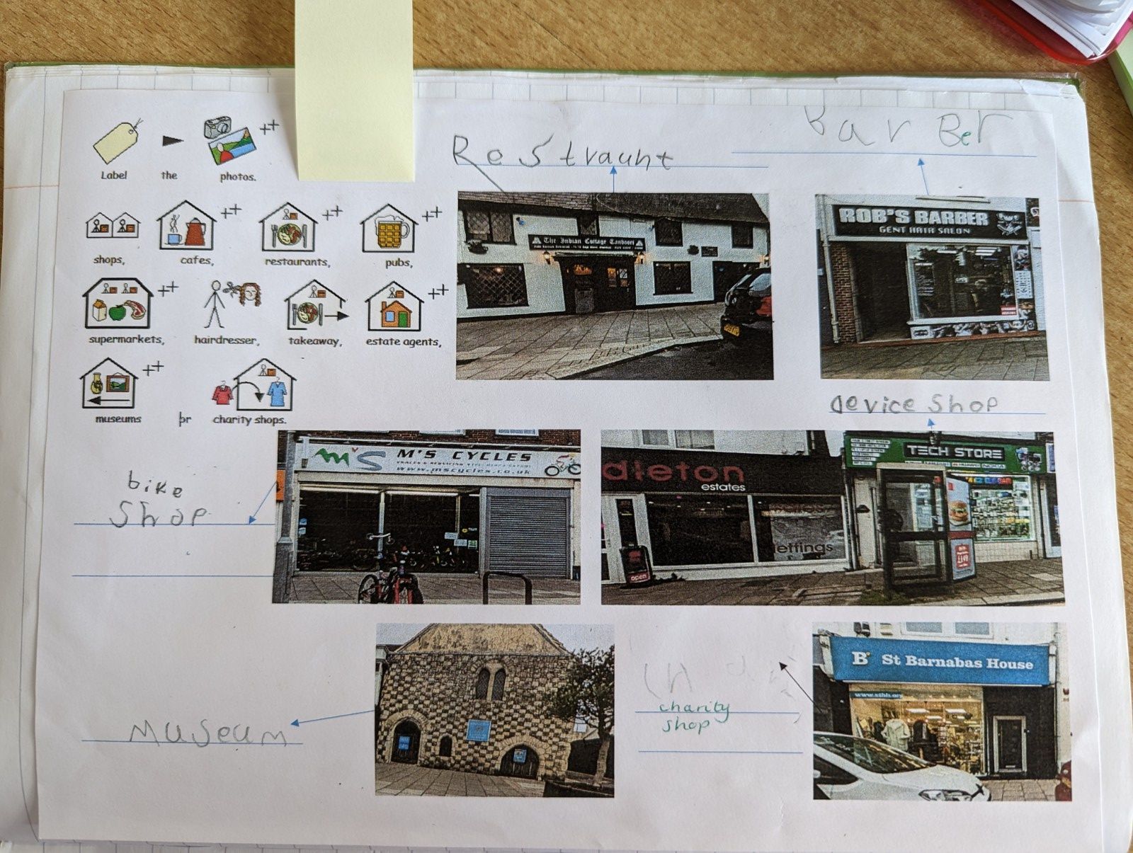
We went on a schoolt rip to Shoreham high street. We labelled the land use of some of the buildings.
PXL20230623145845210.jpg2812We went on a schoolt rip to Shoreham high street. We labelled the land use of some of the buildings.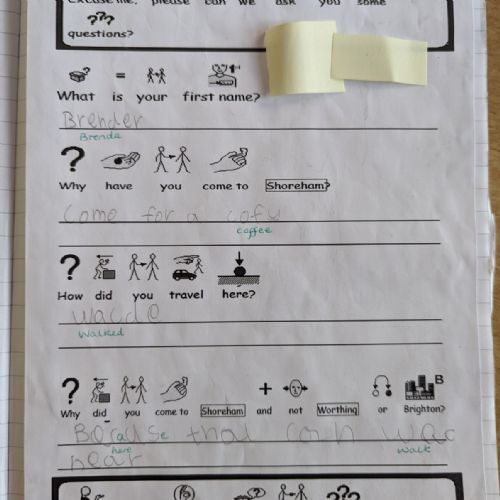
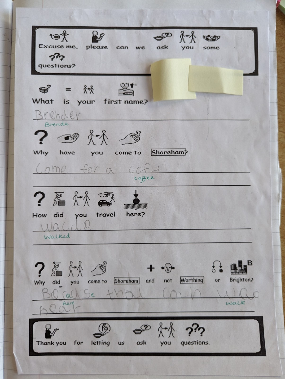
We interviewed some members of the public to find out what they thought about Shoreham.
PXL20230623150203319.jpg2816We interviewed some members of the public to find out what they thought about Shoreham.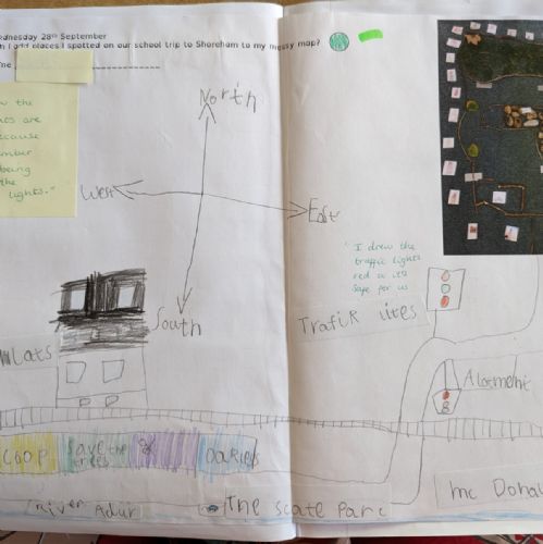
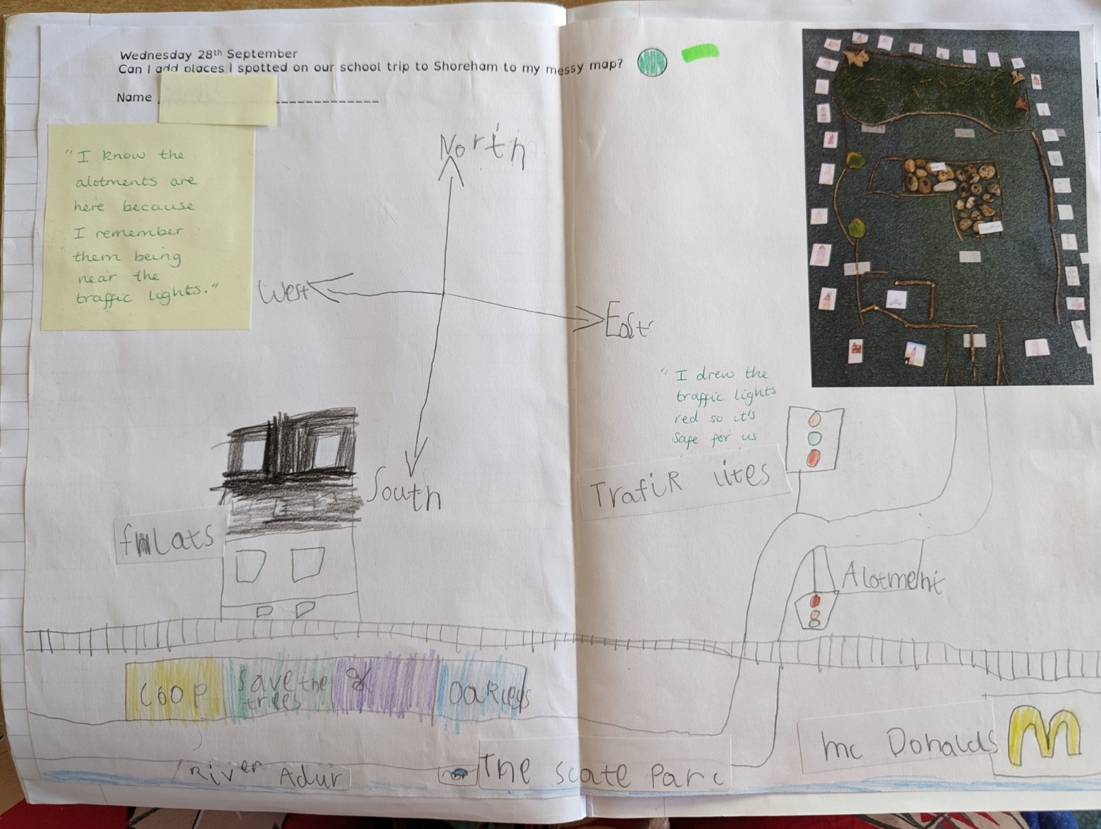
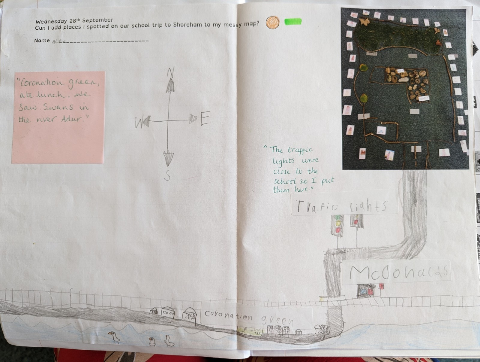
Before our school trip we used Google Earth and Google Maps to plan our route to Shoreham. After our school trip we made a map of our route and Shoreham high street.
PXL20230623150131849.jpg2814Before our school trip we used Google Earth and Google Maps to plan our route to Shoreham. After our school trip we made a map of our route and Shoreham high street.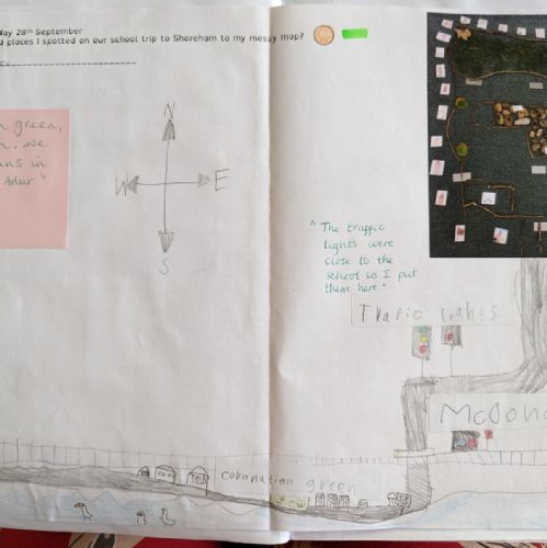
Before our school trip we used Google Earth and Google Maps to plan our route to Shoreham. After our school trip we made a map of our route and Shoreham high street.
PXL20230623145904040.jpg2813Before our school trip we used Google Earth and Google Maps to plan our route to Shoreham. After our school trip we made a map of our route and Shoreham high street.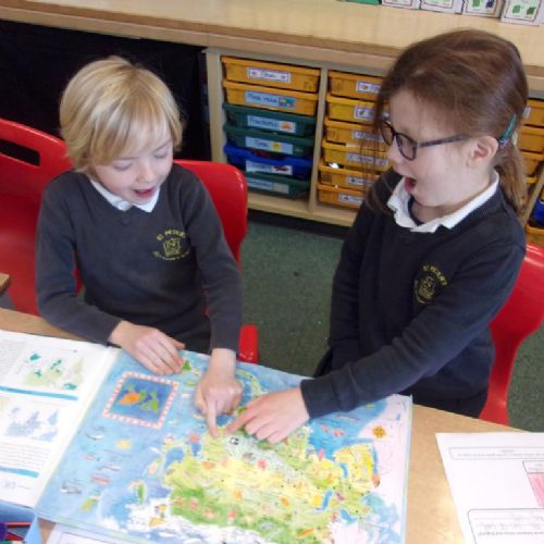
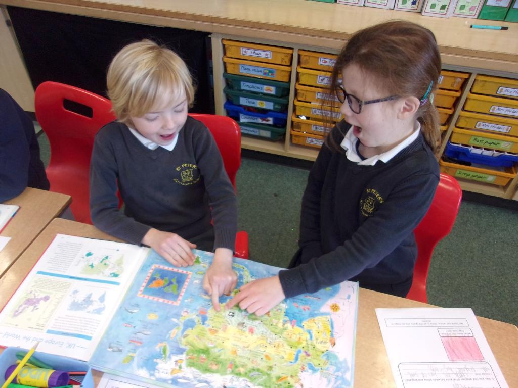
Locating China using atlases
Locatingchinaatlas.JPG2804Locating China using atlases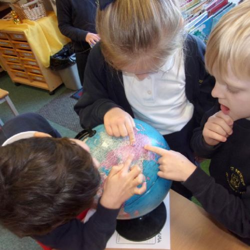
Locating China using globes
LocatingChinaGlobe.JPG2805Locating China using globes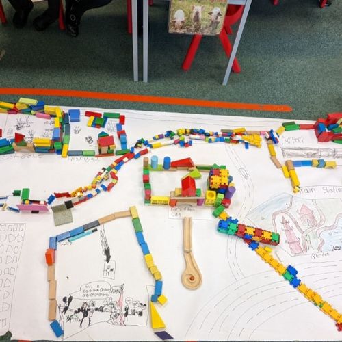
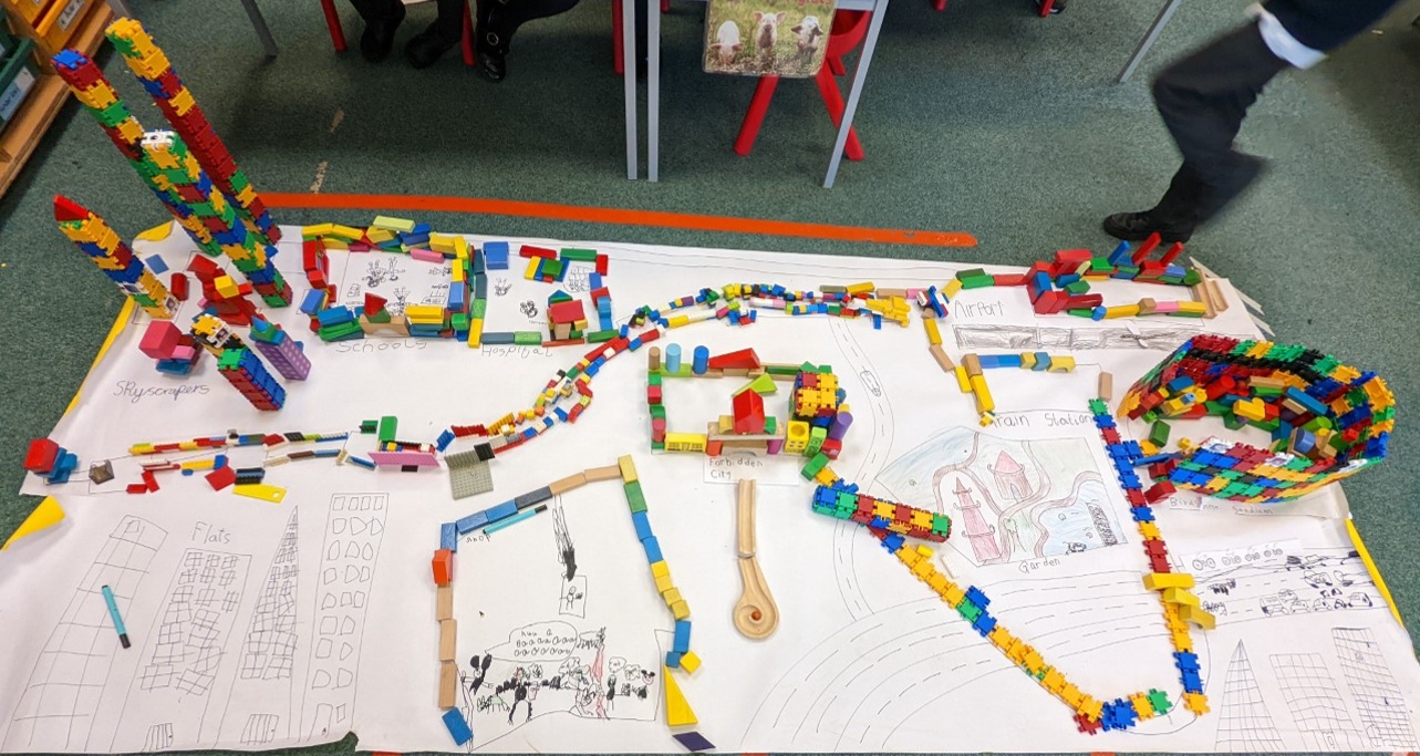
We made a messy map of Beijing
Beijing.png2800We made a messy map of Beijing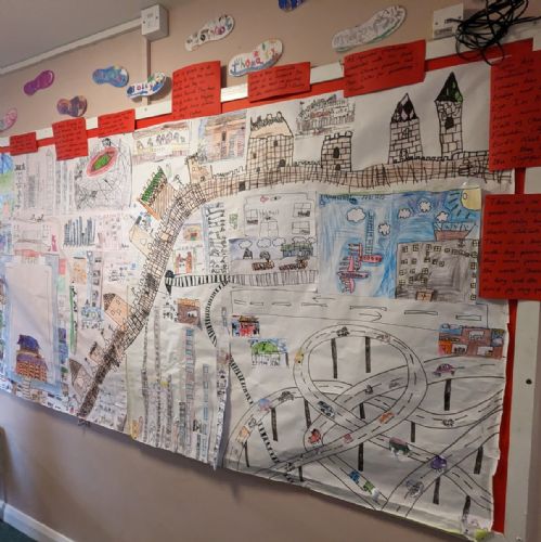
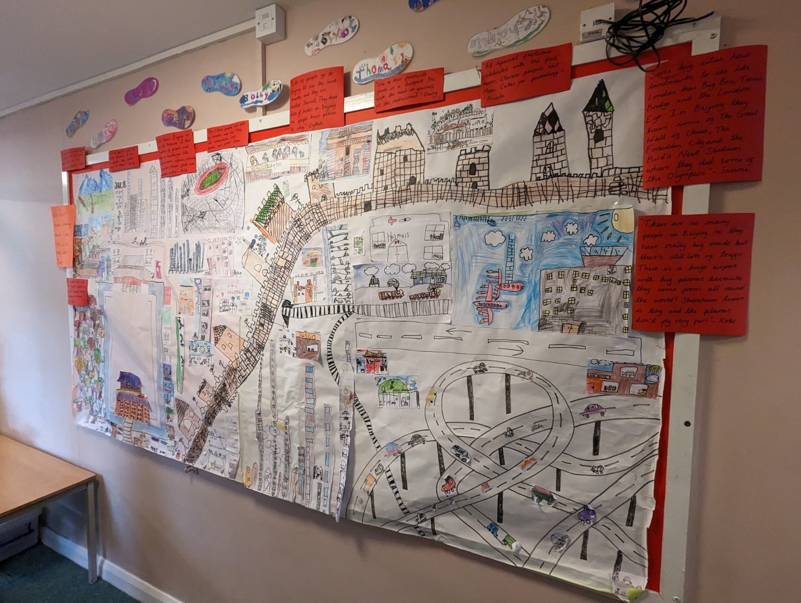
Here is the class map that we made of Beijing.
PXL20230510140306180.jpg2808Here is the class map that we made of Beijing.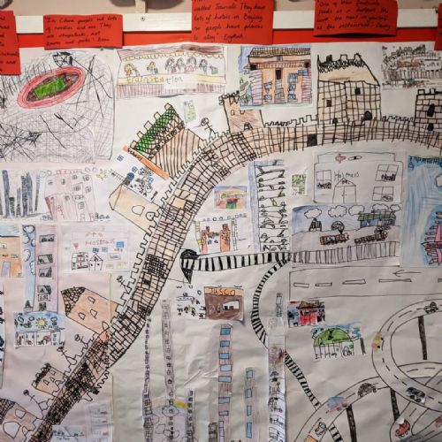
Here is the class map that we made of Beijing.
PXL20230510140315233.jpg2809Here is the class map that we made of Beijing.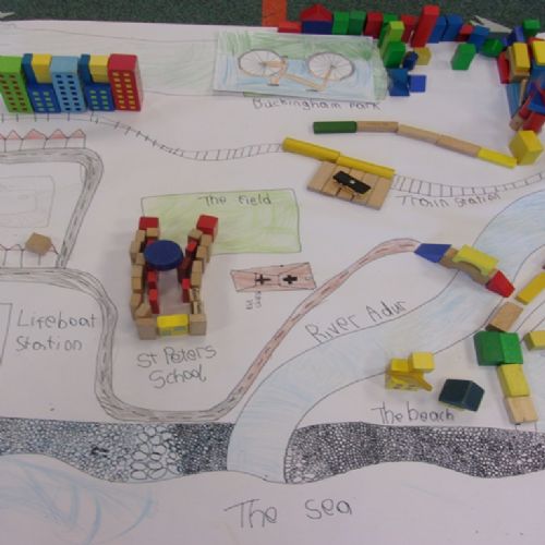
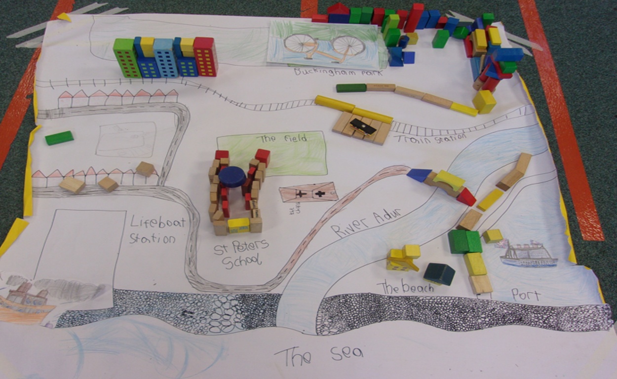
We made messy maps of Shoreham
Shoreham.png2807We made messy maps of Shoreham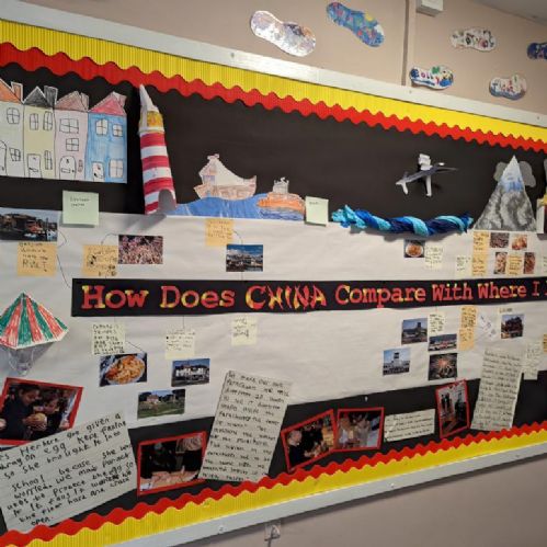
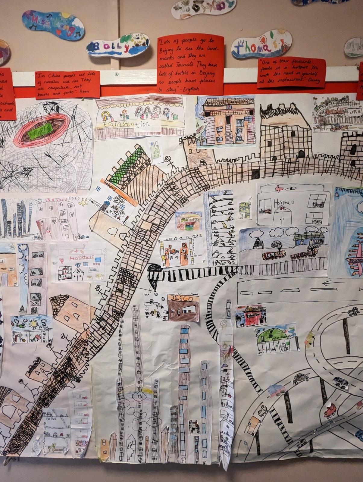
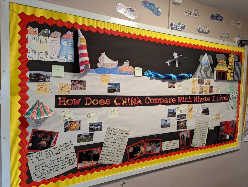
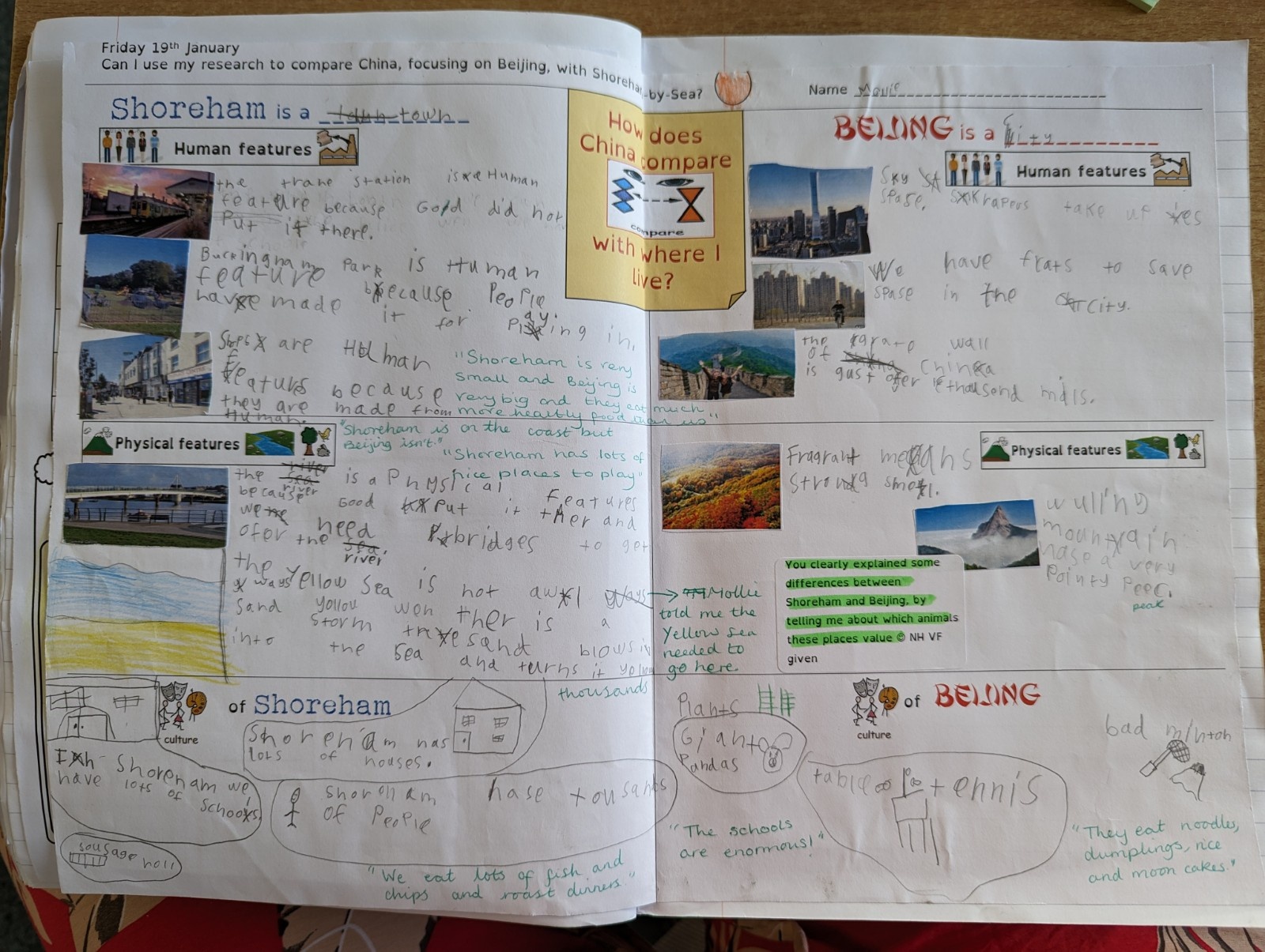
We made our own display board to show what we found out about our enquiry question.
Chinadisplay.jpg2802We made our own display board to show what we found out about our enquiry question.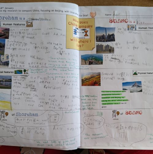
We made our own mind maps to show what we found out about our enquiry question.
PXL20230623150321891.jpg2810We made our own mind maps to show what we found out about our enquiry question.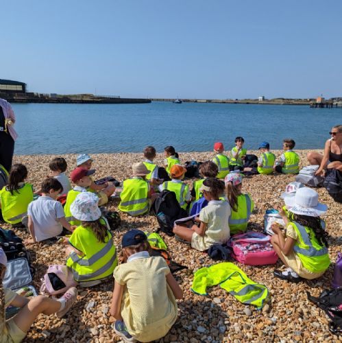
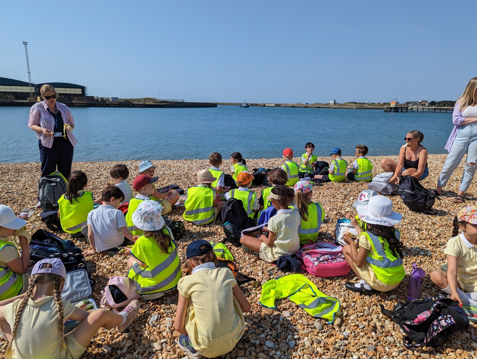
As part of our 'To the Rescue!' topic we went to the Lifeboat Station. We planned our route and learnt about why the RNLI is needed in Shoreham because of the beach, port and River Adur.
PXL20230614085854352.jpg2862As part of our 'To the Rescue!' topic we went to the Lifeboat Station. We planned our route and learnt about why the RNLI is needed in Shoreham because of the beach, port and River Adur.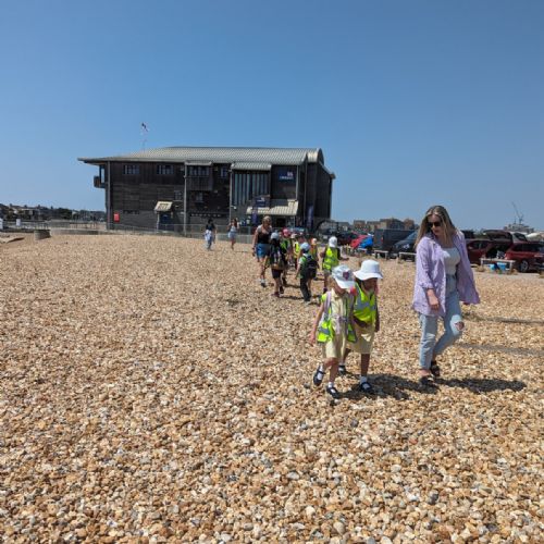
As part of our 'To the Rescue!' topic we went to the Lifeboat Station. We planned our route and learnt about why the RNLI is needed in Shoreham because of the beach, port and River Adur.
PXL20230614110537146.jpg2863As part of our 'To the Rescue!' topic we went to the Lifeboat Station. We planned our route and learnt about why the RNLI is needed in Shoreham because of the beach, port and River Adur.